University of Misan Holds a Training Course on the Potentials of Geospatial Technologies in the derivation of Morphometric Maps
University of Misan Holds a Training Course on the Potentials of Geospatial Technologies in the derivation of Morphometric Maps
The College of Education at the University of Misan organized a training course in the field of potentials of geospatial technologies in the derivation of morphometric maps with the participation of researchers and postgraduate students.
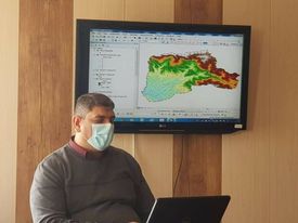
The training course which held by Dr. Muhammad Abbas Jaber started with giving attendees an introduction about the significance of two important technologies: remote sensing and geographic information system (GIS) in deriving morphometric maps based on the digital elevation model (DEM), satellite images of the U.S. Landsat satellite, the QuikBird satellite images, and topographic maps.
It emphasized the use of modern methods in deriving morphometric maps and moving away from traditional methods through a number of tools, which are used for manipulating extraordinary values, the direction of streams flow, the areas of water pool, the tool for controlling the details of inland waterways, and eventually linking water basins (channels) and calculating river levels by a group of Spatial analysis tools.
Moreover, it tackled the importance of these techniques in deriving river valleys, determining their levels, calculating the areas of river basins as well as the lengths of the levels. Further, they are classifying waterways into levels based on Strahler and Sharif, calculating the perimeter, length and width of the basin, and based on those derived characteristics, all the laws of morphometric properties were applied.